The Rain Shadow Effect
I’ve discussed this in the past, and you might have learned about this in your geography classes, but I wanted to dedicate a short, clear, beautiful article to it. I wrote it first as a Twitter version, and made it even better for the article.
This gif of the Rock of Gibraltar gives an intuition for why many of the world’s deserts are next to rainforests:
Here’s a better quality video:
What's happening here?
How can you use that to predict where there will be deserts or rainforests?
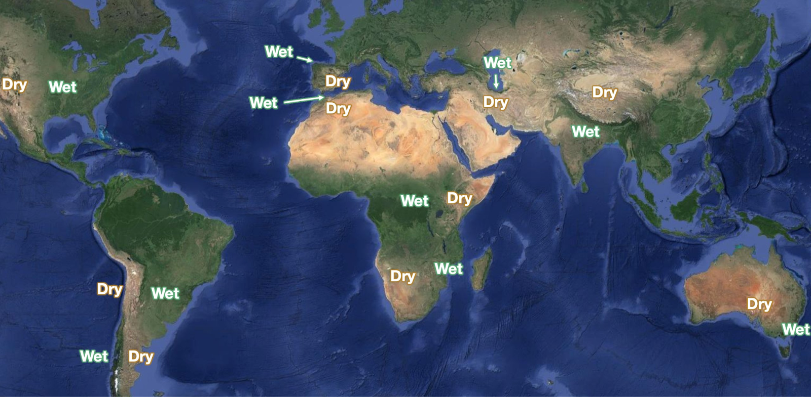
Look at the map below: In some places, deserts and lush forests are side by side. Why?
The mountain chains between them:
The effect is called the Rain Shadow:
Wet air comes from the sea
It hits mountains and goes up
Higher altitudes are cooler, so the air cools
That condenses water (like the droplets on your Coke glass)
Rain falls
The air that gets past the mountains is dry
The left part of this diagram is what's happening in Gibraltar: You can see the water condense as the air lifts up. But the Rock of Gibraltar is not tall enough for that to become rain, so the cloud keeps going.
You can get an intuition here for the dry air past the mountains—the lee side effect:
These mountains are tall enough to create condensation, but not tall enough to catch all their moisture, so some of it remains in the wind that falls down. As it falls, water evaporates again. The wind after the mountain is drier than before the mountain.
You can see this in this video from South Africa, where the taller mountains produce a drier wind afterwards (leeward).
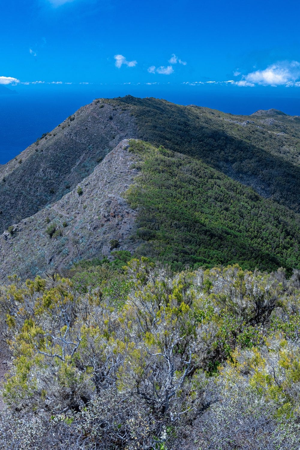
If the mountains are tall enough, they can completely stop the water, as I’ve shared a couple of times in the past:
This picture is from the same mountain range, in the Canary Islands:
You can therefore predict where to find a bunch of juxtaposed rainforests and deserts in the world by asking two key questions:
1. In what direction do seaborn winds blow?
2. Where are there tall mountain ranges?
The 1st question is mainly determined by the rotation of the Earth:
Why is the Earth’s rotation causing this?
Winds Interlude
(Don’t read if you don’t want to understand this, you don’t really need it, and it includes the Coriolis Effect, one of the hardest concepts to grasp intuitively in Earth science. I’m also told this is not quite right; exploring this).
Imagine you put a rug in water and then you pull the rug. Will water come with it? A little bit, because the rug drags the water. But it doesn’t drag too much of it. Water moves more slowly than the rug.
That’s what’s happening with the Earth’s atmosphere. The Earth is a sphere spinning in space. The atmosphere is not fixed to the surface, so when the Earth spins, it drags the atmosphere with it, but the atmosphere moves more slowly than the Earth. The Earth spins eastwards (that’s why the Sun appears on the east) so that’s why it looks like winds come from the east at the equator (the fastest-spinning part of the Earth).

So that’s why winds at the equator go westward. But hold on, the atmosphere is not flat!
Because the equator is so hot, air there goes up. But that air must come down at some point, and it then pushes winds towards the equator when close to it, in the Hadley cells.
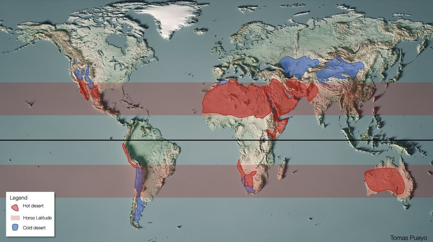
The air coming down from the high atmosphere has very little water in it, so the land around it tends to be desertic around the Earth. We call these the Horse Latitudes. You’ve already seen this in this blog:
But because of the size of the Earth, there is more than one cell. The Ferrel cell is the next one as you move away from the equator.
The winds in the Ferrel cell are called Westerlies (in green in this diagram), because they come from the west1. But why do winds in the Ferrel cell go from west to east?
(From now on, I’m going to focus on the northern hemisphere because that’s where most of the world’s population is. A mirror image is true for the southern hemisphere.)
You can see on the diagram that the Westerlies first move north and then turn eastward. Why?
In the south of the green band, what prevails is the strength of the air coming down from the equator, and then moving north. But the farther north, the more the westerlies blow intensely towards the east. What causes this? The Coriolis Effect.
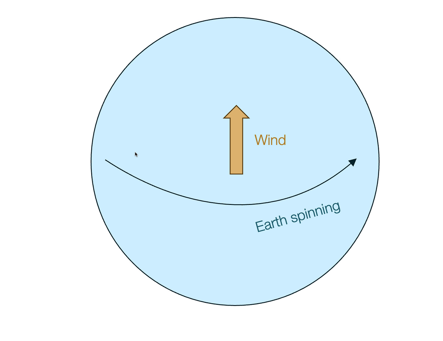
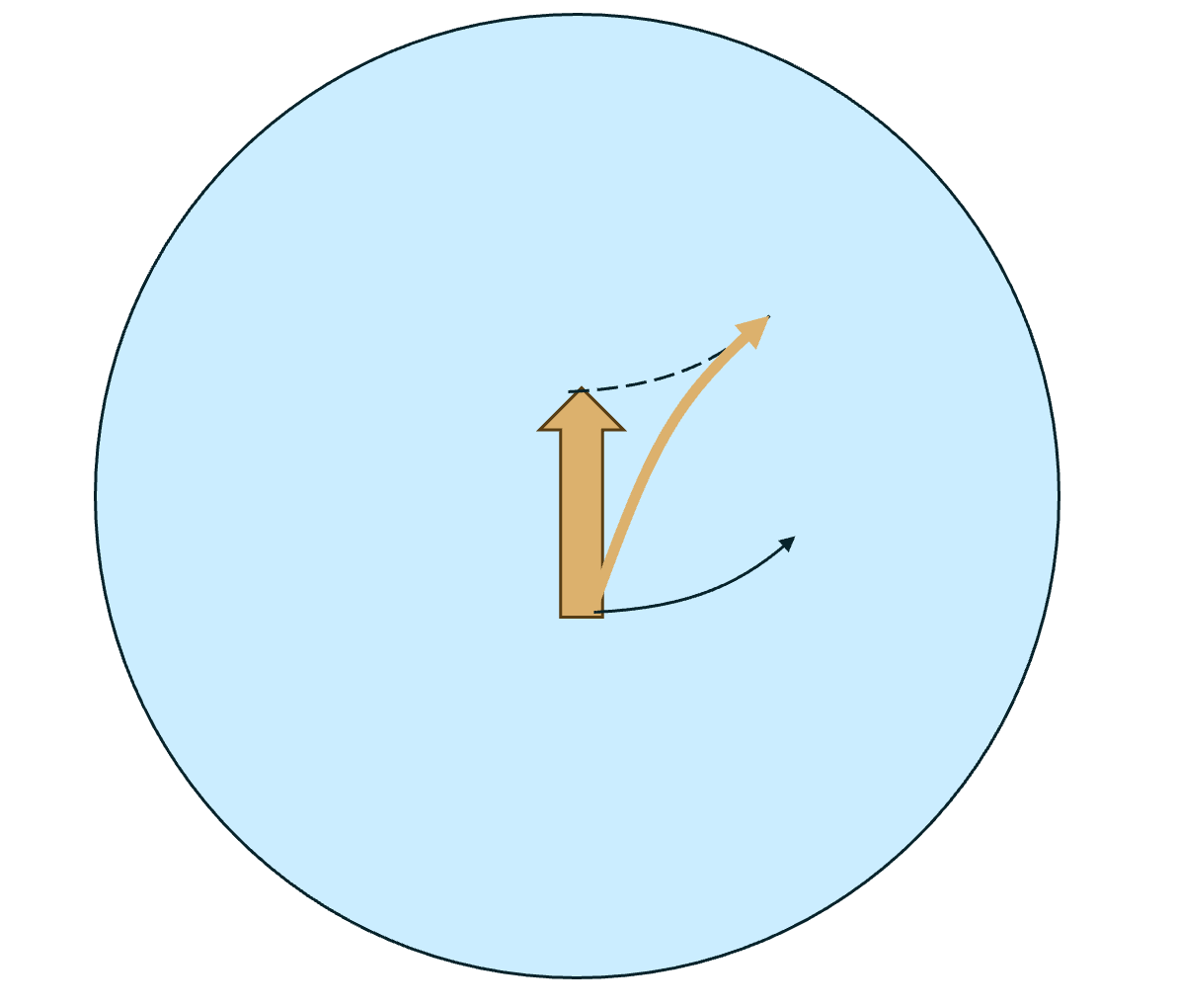
Take these Westerlies. They appear to us as if they were going north.
But the Earth is also spinning, so they’re also going east. And quite fast! Because closer to the equator, the Earth is moving faster.2
Closer to the pole, however, the Earth moves more slowly.
Coming from closer to the equator, the Westerlies are traveling eastward fast (with the Earth), so when they arrive north, they appear to be going eastward.
So this is why winds appear to be going westwards around the equator and eastwards away from it. Then everything switches again around the poles, and if the Earth was bigger, we would have more stripes like this—like Jupiter:
End of the winds interlude
What this means is that, close to the equator, if winds from the sea find a mountain range, the east side will be very wet and the west side dry. The taller the mountains, the stronger the effect. So where do we have tall mountains around the equator?
It doesn’t get taller and more of a north-south barrier than the Andes. What’s the result? Brazil and northern Argentina are wet, but past the Andes it's drier—like the Atacama Desert.3
Eastern Australia is wet, western and central Australia are drier.
This effect is inverted if you go further north or south where you switch from Trade Winds to Westerlies and the prevailing winds change direction.
The inversion is most striking around the Andes:
The same happens in Northern Spain and Northwestern Africa: Prevailing winds come from the Atlantic, and both areas have mountains.
The mountains catch the wind's moisture and create vegetation. Past the mountains, it's dry or even desertic:
Look at these two pictures I’ve shared in the past. They're taken 5 km away, before and after a tunnel in northern Spain:
You can also see it in Hawaii. Since it’s made of volcanic islands, they all have mountains in the middle stopping the moisture from the wind:
You end up with islands like Kauai, with jungle to the east and desert to the west:
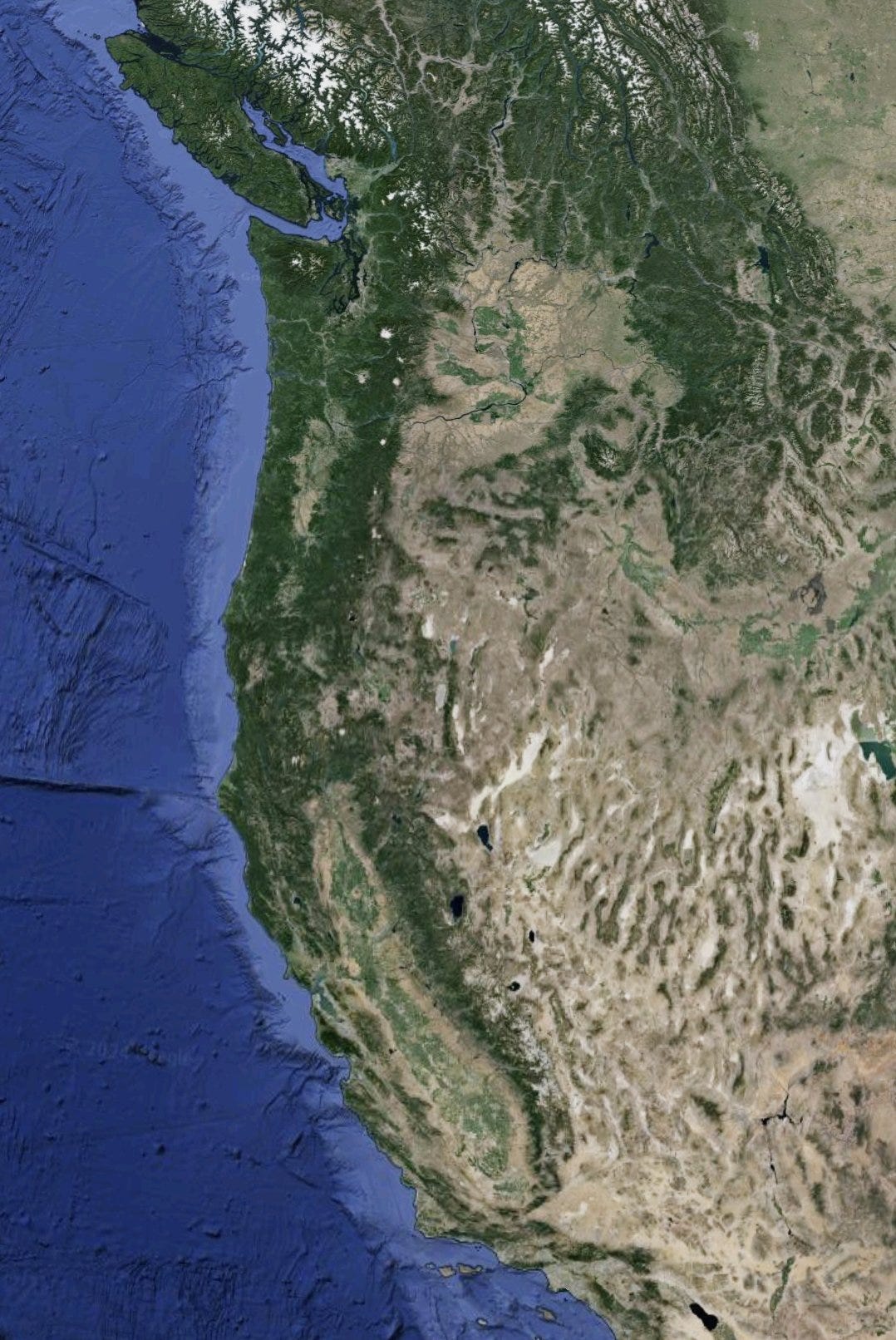
Meanwhile, the US’s West Coast gets the winds from the Pacific and the Rockies stop everything:
That’s how we get a very wet California, Oregon, Washington State, and British Columbia, while Utah, Arizona, and New Mexico are nearby deserts. In some places, the contrast is stark, like here in Oregon:
But the rotation of the Earth is not the only driver of winds.
Monsoons
Monsoons are driven by big masses of land dragging in moist air from warm oceans. This is true in Africa, where monsoons come to central Africa from the west and to southern Africa from the east:
In June – August, as the Earth tilts, the hottest area in Africa shifts north from the equator. That landmass is so huge that lots of hot air goes up, sucking in moist air from the Atlantic, which then drops its monsoon rains. That’s the diagram on the left.
In December – February, the hottest area moves south, and here the wind comes from the Indian Ocean to the east, displayed on the right.
Here’s an animation:
The result is that in the northern part of Africa (but below the Sahara), all the water is on the west and the east is dry. This reverts in the south:
To the north, Somalia is a desert, because the Ethiopian Highlands catch all the rain (forming the Nile which gives life to ~200M ppl).
To the south, Namibia hosts the Kalahari desert, because eastern South Africa and Mozambique catch all the water.
Here’s a map of altitude:
Here’s a map of annual rainfall:
And here’s the resulting satellite:
Note how something similar happens around Madagascar, with the east coast wetter than the west coast:
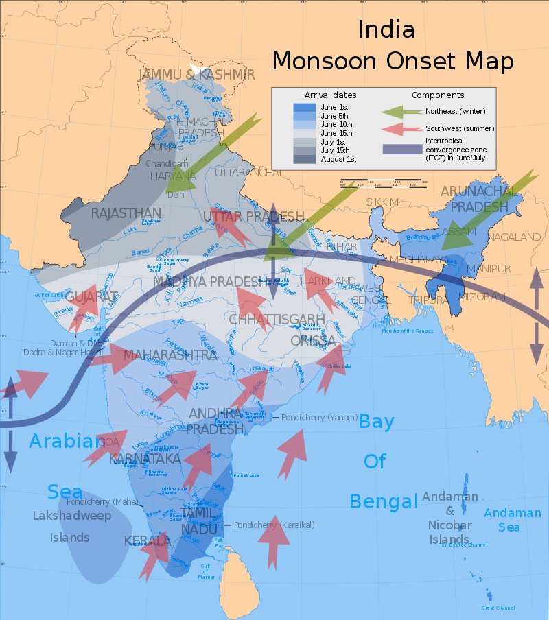
The same occurs in Asia, more specifically India. Here are the monsoons:
Caused by the huge landmass of Asia:
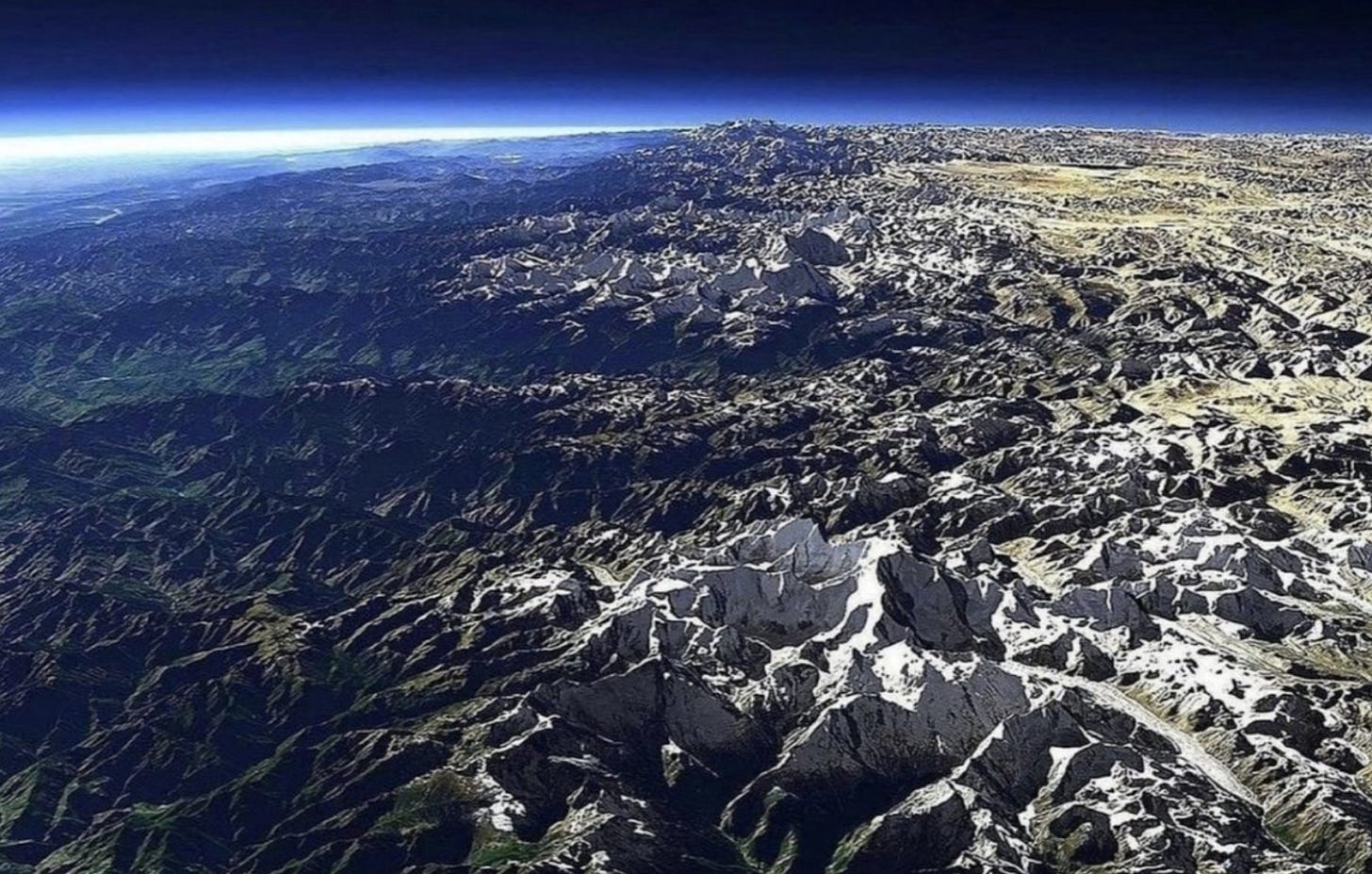
It’s why India is so much wetter than Tibet. This is a side view of the Himalayas and Tibet.
It’s not the only place in India. For example, you can see it in southern India, around Kerala:
Or farther north, the Thar Desert, caused by the Aravalli Range:4
Other Rainforests and Deserts
Similar effects can be seen in other areas of the world where mountain ranges split deserts from rainforests. Here, in the Middle East, you have at least three examples:
This is how you get amazing pictures like those of Tehran, the capital of Iran:
Tehran is at the edge of a desert but towered over by snowy mountains.
If you thought Iran was just desert, I present to you its coastal Hyrcanian Rainforest:
This is also the case in Saudi Arabia and Yemen. Why do you think people live mostly on the west and southern borders (where Mecca and Medina are)? They get the little water carried by the wind from the Red Sea.
And here is its population density:
So that's the rain shadow effect.
Premium article this week: Why Is Bangladesh so Densely Populated and also Exposed to Sea Level Rise?
Winds are named after their origin because most wind language comes from sailing, and in sailing you refer to wind based on where it comes from.
It needs to complete a spin in 24h, no matter where you stand! The poles are on the rotation axes so they barely move, but around the equator, the surface is as far as it can from the rotation axis, so it turns faster.
The Atacama combines two sources of dryness: The Rain Shadow effect from the Andes, and the fact that it’s on the Horse Latitudes, where dry air falls from high altitudes.
Not really caused: That area was going to be dry anyways because of the Horse Latitudes and the lack of monsoon. But it’s much drier than it would be.















I really like the wind interlude!
A small correction, the image you have of the US West Coast is primarily defined by the Cascade and Sierra Nevada mountain ranges, with the Rockies not starting until further east. I think you fully achieved your goal of a clear and concise breakdown of the rain shadow effects globally!