The Top 50 US Cities: Why Are They Where They Are?
I’m working on a project that started with the last article: Deserts, Tornadoes, Hurricanes, Snow, Paradises, Swamps, understanding the climate and geography of the US. Next week, we’ll see the culmination of that project.
Today, I share with you why the top 50 US cities are where they are. You will understand the patterns that make cities what they are. Most of them are geographic, but there are also some other factors. The first 25 cities are free and the second half is for premium subscribers.
These are the top 50 cities in the US, in terms of the population of their metropolitan area:

Why are they where they are? Let’s start with the top 25—but not in order, as it’s easier to group them thematically.
Trade Hubs
New York (1)
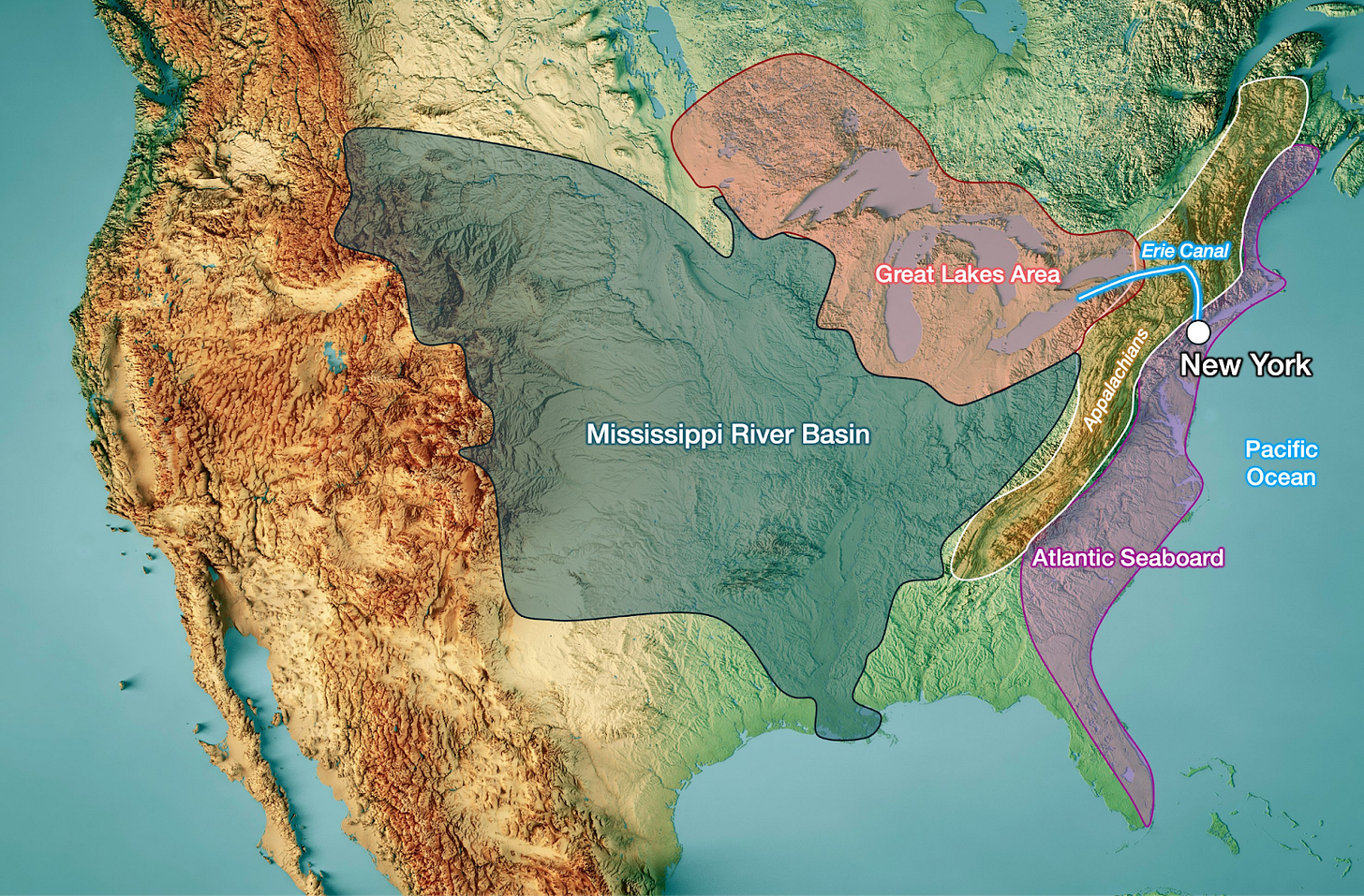
We covered New York in this article. The short take is that New York emerged as the connection between the Great Lakes area and the Atlantic Seaboard, thanks to the Erie Canal, which was built in the 19th century.
It became the major port for transatlantic trade, too. In other words, New York’s origin is its canal and its port, which exist thanks to the Hudson and Mohawk Rivers, which are the best places to cut through the Appalachians, and happen to reach the coast at New York.
Manhattan is well placed because it’s protected from the sea by being located upstream of the Hudson.
Because it was the original trade port, it got the railways that reinforced its position as a trade hub, which then justified the roads and highways, and eventually, the airports. Trade hubs have network effects.
Chicago (3)
Chicago (also covered here) is similar to New York, except it’s the trade hub between the Mississippi River Basin and the Great Lakes.
Like NY, it became a trade hub in this way, then a hub for railroad, highway, and airport.
Atlanta (6)
Atlanta (covered in depth here) is also similar to New York and Chicago, except it’s not on any coast, and instead was a pure railway—and then highway and airport—trade hub between the Mississippi Basin and the Atlantic Coast (hence “Atlanta”) south of the Appalachians.
At the time, the big cities were Nashville, Chattanooga, Macon, Augusta, and Savannah, and Atlanta was literally the ideal spot to connect them all:
Between them all
Just south of the Appalachians
Close to the Chattahoochee river to get its water
On its eastern riverbank to build only one bridge from Macon/Augusta to Chattanooga
San Francisco (13)
Explained in the article about California, San Francisco is the trade hub between the California Central Valley and the world:
It has a great deep water port, thanks to the San Francisco Bay
Which is also the estuary of the Sacramento River, which serves all the northern Central Valley, including Sacramento and the Gold Rush areas.
Detroit (14)
Detroit is the trade hub between Lakes Huron and Erie, and between those lakes and the land around them. Its name means "strait" in French.
Early on, it had very lucrative trades in fur and timber.
As such, it developed a shipbuilding industry to trade them.
The ironworks, machine shops, and foundries needed for shipbuilding developed the local labor’s skill and supply chains, which were then used for stoves, railcars, and agricultural equipment, later bicycles, and later cars.
US West Coast
Los Angeles (2)
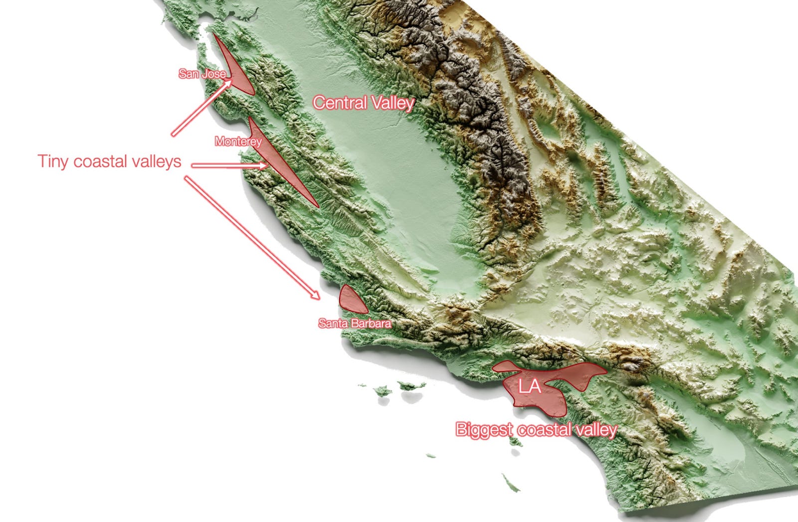
LA1 didn’t start as a trade hub because it doesn’t have a deep water port, nor a big navigable river to use for trade with its hinterland.
It does have a big plain that was ideal for agriculture, on a coast that is otherwise quite mountainous.
That was enough to get connected to San Francisco via railway, and then to the rest of the US via the Santa Fe railway. It thereby became the Southern California trade hub.
Later, it had the luck of getting oil. Its good weather, diverse surrounding landscapes, and distance from the East Coast centers of power attracted the movie industry. During WW2 it became an important military port, and it has maintained its port and heavy industries since then.
That said, this area of the West Coast is dry! So LA had to source its water from all over the region.
San Diego (18)
San Diego is similar to LA, except it has a smaller valley, and its role as a trade hub (primarily with Mexico, since it’s on the border and has Tijuana on the other side) arrived later. For both these reasons, it’s smaller.
Here it's clear that San Diego is located in a worse spot than LA, since it doesn’t have a big, flat coastal valley.
Seattle (15) and Portland (25)
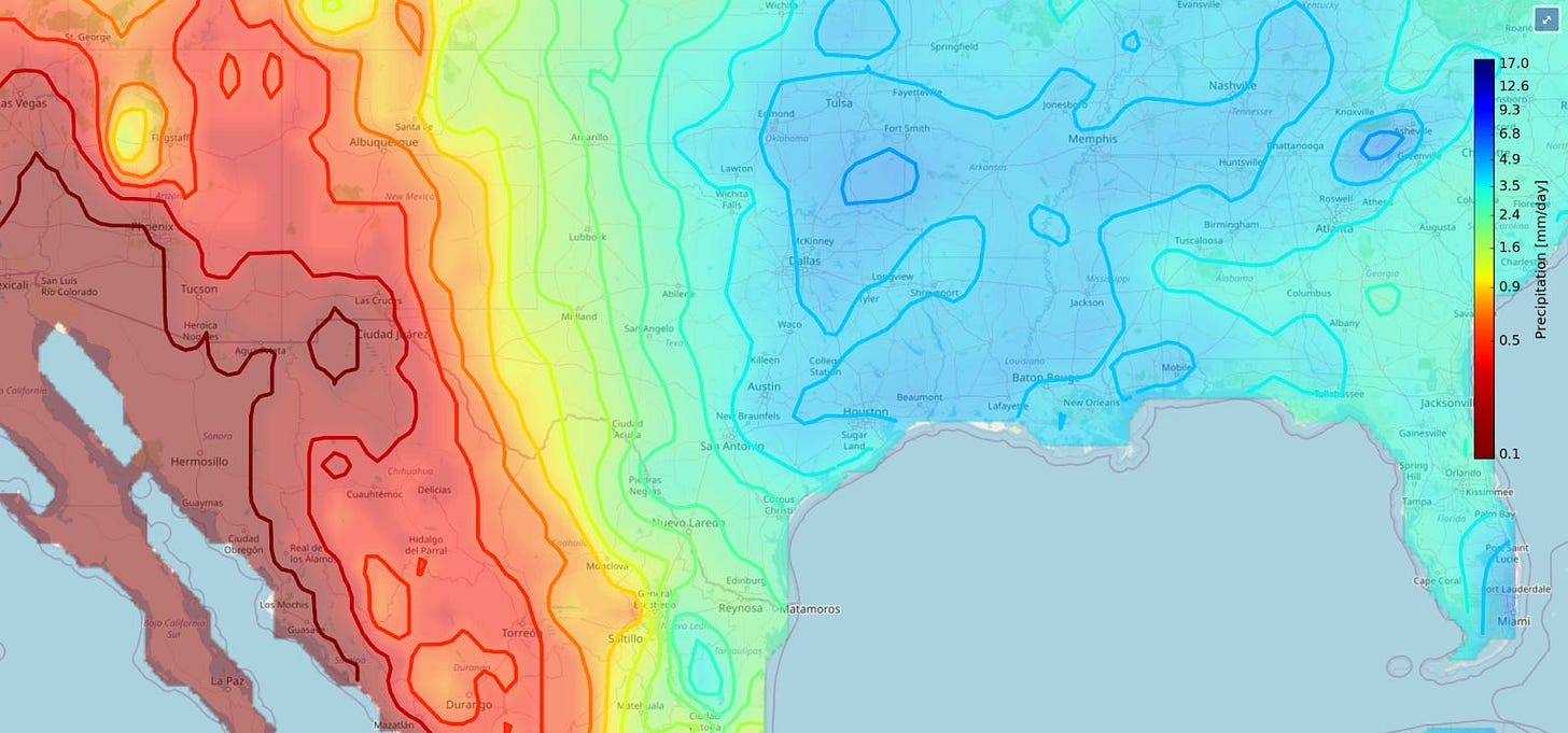
LA and San Diego are as dry as Terms & Conditions. But the opposite is true for the Pacific Northwest, where we find Seattle and Portland. In fact, that area has the most rain of the entire US. Why?
Winds from the Pacific are very weak at the latitude of LA and SD, so they don’t bring much moisture onto the land. But they’re quite strong at the latitude of Seattle and Portland, and there, they bring a ton of moisture.

Notice, however, on the rainfall map, that there are two parallel bands of rain in the west of Washington and Oregon and a reasonably dry area between them. That area is also much warmer:
That’s because there is a valley between two coastal mountain ranges: a low-lying one close to the coast, and the extension of the Sierra Nevada to the east. Each range catches some rain.
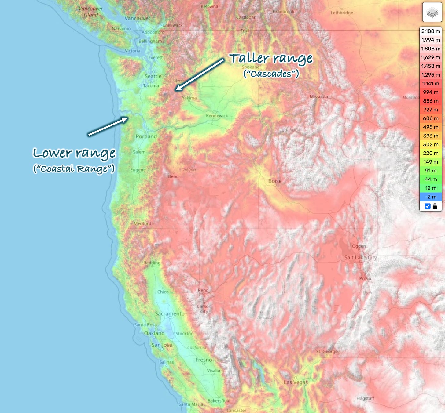
Meanwhile, the valley between the two mountain ranges is protected, warmer, and drier. That’s why Seattle, Portland, and most settlements in the area are in that central valley and not on the coast.

Seattle, in the Puget Sound Lowlands, is protected from the aggressiveness of the Pacific Ocean, its rains, and winds by the Olympic Mountains—the Coastal Range at that point. But it also has a deep water port, which allows it to trade the hinterland goods with the world, historically mostly timber, gold, and coal.
Eventually, like SF and LA, it became an important WW2 port.
Portland is very similar.
Except that instead of being on a coastal bay and functioning as a gateway between the Pacific Northwest and the world, Portland is at the confluence of the Willamette and Columbia Rivers, and serves as the gateway between the Columbia River Basin and the world.
Today, ocean freighters can travel upriver as far as Portland and Vancouver (the Washington State one, no the Canadian one), and barges can reach as far inland as Lewiston, Idaho.
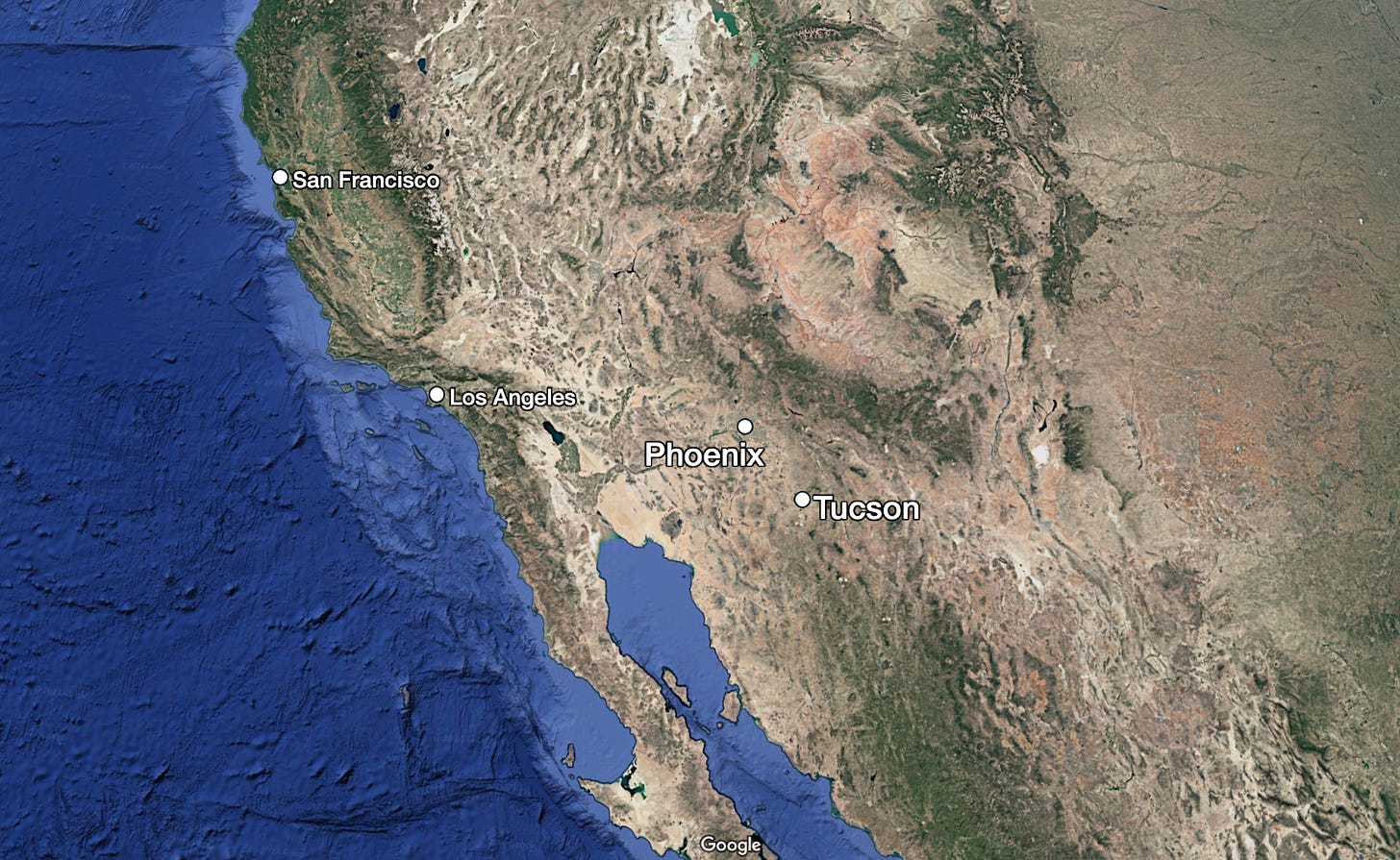
So that’s the West Coast. If you move farther east, you’ll find Phoenix and Tucson in a semi-desert region. Why?
Rocky US
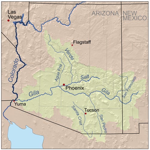
Phoenix (10) and bonus: Tucson (52)
Notice the green around them? It’s the Gila River Basin:
They are formed by tall mountains just to the north:
These river basins provide Phoenix with the majority of its water, but the rest—and a lot of Tucson’s—comes from the Colorado River Basin, which catches nearly all the rain from the southern Rockies:

The river’s basin has been engineered to distribute water where it’s needed.
Without this water, cities like Phoenix or Tucson couldn’t exist.
Where the Mountains Meet the Plain
If we move east, we find the last urban centers in the western half of the US. Do you know what they are?
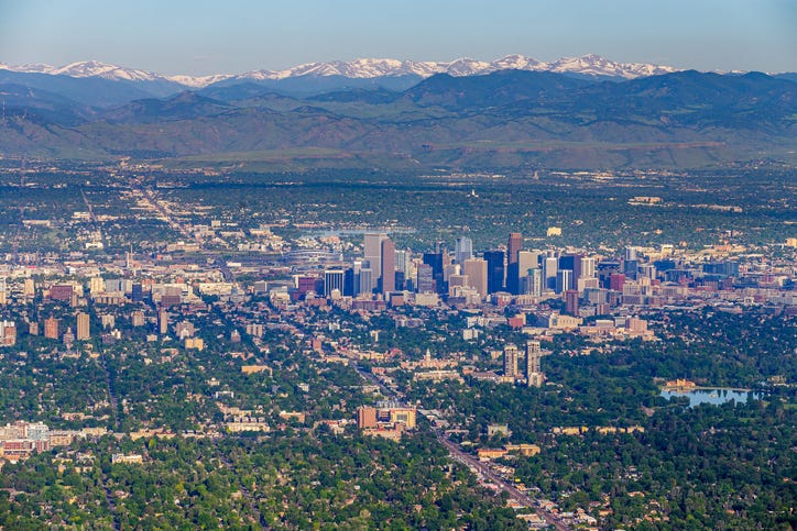
Denver (19)
The big one to the north is Denver, with its sister cities Boulder and Colorado Springs.
They’re there for the same reason many other US cities are where they are: They are at the meeting of a river and a mountain fall line.
In the case of Denver, the river is the South Platte, a tributary of the Mississippi, fed from the Rockies at one of their tallest points—the Front Range.
Because it’s so high in elevation, it manages to capture some of the moisture from the Pacific, and that’s why Denver has enough water despite being in the middle of the country.
The urban center south of Denver is Albuquerque, with its little brother Santa Fe nearby. Albuquerque is dry, but receives the water from the Rio Grande valley:
Rivers need a crossing, and Albuquerque appeared on the map because that’s where an early east-west railroad crossed the river. From there, the city grew and became the default choice for a road to cross the river, so Route 66 was built and increased Albuquerque’s centrality in New Mexico.
The third notable center to the south is El Paso and its bigger brother just south of the border, Ciudad Juárez, in Mexico. These cities exist mostly because of the border, as a way to take advantage of border arbitrage. They are located at the westernmost point on the US-Mexico border marked by the Rio Grande.
The final thing left to understand is where, outside of these centers I’ve mentioned, people live in the western US: Most of the secondary cities that I haven’t mentioned yet are simply placed along the most important rivers of the region and their tributaries. You can see the night lights of the region here:
All of this is completely unlike the eastern US.
Eastern US
The Eastern US is so different it could be another country. What do you notice when you look at it?
Many more cities in the East than the West
The spacing between cities is much more uniform
On the western (the central plains) side, a grid is pretty obvious
On the eastern part, close to the coast, we can see a long line of larger cities with a gap in the middle, that includes cities such as New York, Boston, Philadelphia, DC, and Atlanta
Big cities are distant from each other, and are surrounded by smaller cities, which in turn are surrounded by smaller cities
There are some big clusters, like the northeastern megalopolis, the Texas Triangle, or Florida
The Texas Triangle: Dallas – Fort Worth (4), Houston (5), San Antonio (24) and Austin (26)
I explain it in detail here, but this is the short version:
We often find cities, like Denver, on the fall line of a mountain Range. San Antonio, Austin, and Dallas – Fort Worth are all on the fall line of the Edwards Plateau, so they lie on flat land that make it cheaper to build infrastructure (notably here, railroads and roads) and have rivers that provide water (the ones in Texas are mostly not navigable). Everything west of this fall line also gets substantially less rain, so it’s drier.
All these cities needed a port as close as possible, and Houston became that port. Galveston, established by the Mexicans, used to be the main port here, but in 1900, a hurricane destroyed it. Houston was upstream of Galveston; protected from the sea, yet still navigable, at the confluence of two bayous. Being close to Galveston, it also already had railroads when the hurricane hit Galveston.
Northeastern US: NY (1), Boston, Philadelphia (8), Baltimore (20), Washington DC (7)
A typical place for cities to emerge is at the crossroads between fall lines and rivers coming from the same mountains, because they become the heads of navigation of the river, and because they’re also on the road that follows the fall line (since it’s the first flat area where roads can be easily built):
We see this pattern very strongly in the US Northeast, where the Appalachians get quite close to the Atlantic:
All these cities are:
On the Atlantic Coast
Protected from the ocean
Usually on a navigable river, which allows trade between the ocean and the hinterland2
With a deep water port
On the fall line, which is very close to the ocean here
Charlotte (22)
If you continue down the Appalachians, you soon see Charlotte and Atlanta (which we already talked about as a trade hub), both also on the fall line of the Appalachians.
But since Charlotte doesn’t have as good a port as the other East Coast cities and doesn’t have the benefit of being a trading hub between the Atlantic and the Mississippi Basin, it never grew as much as the others.
Florida
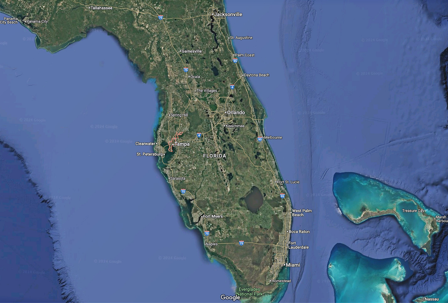
The State of Florida is much flatter than the northeast, and it’s not on a fall line, but otherwise it’s not that different from what we’ve seen. Miami and Tampa are both port cities on the coast, protected from the ocean by bays or river mouths.
Miami (9)
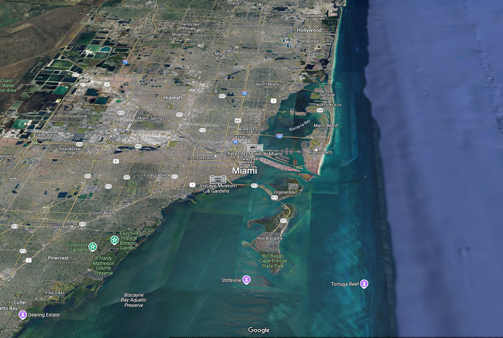
Miami is on the Florida East Coast, protected from the sea by the natural harbor of Biscayne Bay, on the mouth of the Miami River.
Its position in the Southwest, along with its protected bay, made it a prime spot for a port in WW2, during which the city grew immensely.
Since it’s also close to Cuba, it received lots of emigrants to populate it.
Its good weather facilitated unique agriculture like citruses, which made it an early railroad stop. This good weather also brought it tourism, of course.
Tampa (17)
Tampa, on Florida’s western coast, is similar to Miami. It was a Spanish (and later US) fort and settlement, thanks to the protection of Tampa Bay and its deep-water harbor.
This secured it a railroad, which made it accessible and into a hub for trade and tourism.
Like in Miami, good weather helped tourism and agriculture flourish.
Jacksonville (38)
Jacksonville is similar to Miami and Tampa, but at the mouth of the St Johns River:
River
Port protected from the sea
Warm weather
Early railroad
Orlando (21)
Orlando is a bit different. It’s a central point in Florida, connecting all its main cities. Its good weather and many lakes made it into a tourist attraction too.
So whereas Florida cities are not on a fall line, they get the benefit of warmth and sea, which has brought special agriculture and tourism to them.
Most notably, Disney World is there. According to Toby Unwin, Walt Disney picked it because it’s inland:
He didn’t need coast, but rather cheap land
Weaker hurricanes, as they lose steam when they hit land
We have only two cities to go!
The Mississippi Basin
Minneapolis – St Paul (16)
I explain these cities in much more detail in this article, but the gist is that they’re situated at the confluence of the Mississippi and Minnesota Rivers. The combination of their waters makes the river navigable from this point onwards, all the way down to the ocean in New Orleans.
This makes it the Mississippi River’s head of navigation, and that’s relevant because it made it the trade hub for all the hinterland north and west of this point.
St Louis (23)
St Louis is located at the confluence of the Mississippi, Missouri, and Illinois rivers, where they flow into the Mississippi, making the city the trading hub between these four branches.
And there you go, that’s why we find the top 25(+3) cities in the US where we do!
Now let’s cover the cities all the way to 50!


