
How Do Villages Grow into Cities?
Article 2 of A Science of Cities

In our previous article, A Science of Cities, we uncovered the big forces that determine population density, how people gathered in villages, and how some of those villages grew more than others. These forces are food productivity, agglomeration effects, and transportation costs. Today, we’re going to see how these forces, plus a few more, determined which cities grew and which ones remained small. Next, we are going to see how cities are structured inside.
Food Productivity of Cities
The regional productivity of the land will determine the average population density: The more fertile the land is, and the better the technology to extract food out of it, the more food will be available and the more the population will grow. As we saw in Pax Mercatus, inventions like the heavy plow, the horse collar, horseshoes, and horse breeding brought an agricultural revolution to Northern Europe that exploded local population, and that led to the emergence of cities.
The number of people who can live in cities will be determined by the food surplus. For example, if every person can only produce enough food to feed themselves, everybody will be a farmer. But if every farmer only uses half of their harvest, the other half can feed non-farmers, and so 50% of the population will be able to do other work, usually better done in cities. In other words, the food production surplus determines the share of urban population, up to about 80% city dwellers.1
But how does this food reach the cities? In A Connected Place, we discussed how cities were realistically structured:
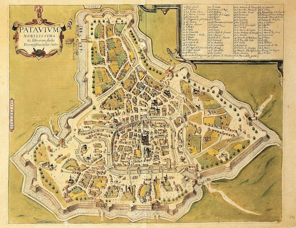
Notice how there’s plenty of farmland inside the city walls. Outside the walls there was more.
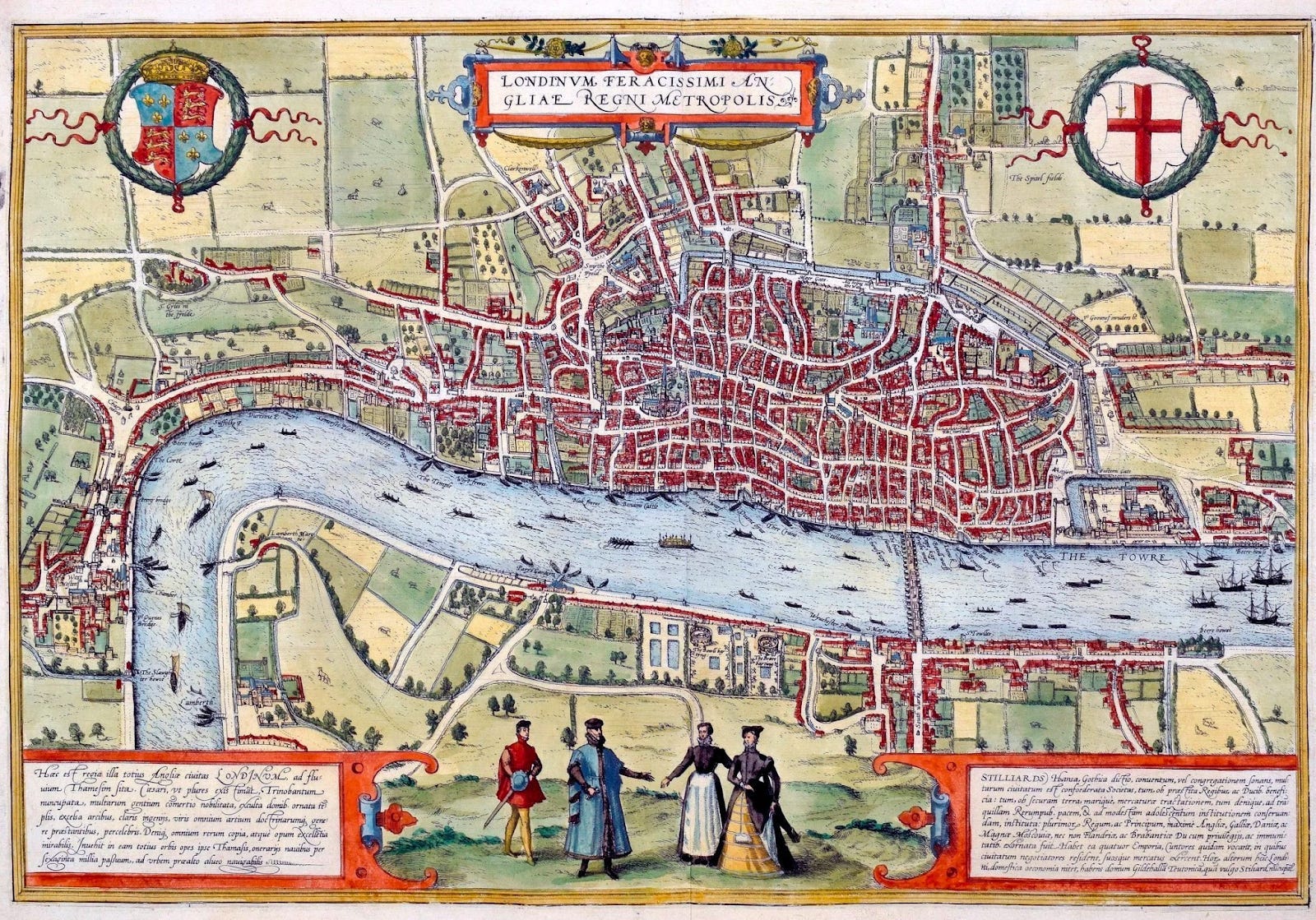
We saw in that article that the simplified model was this:
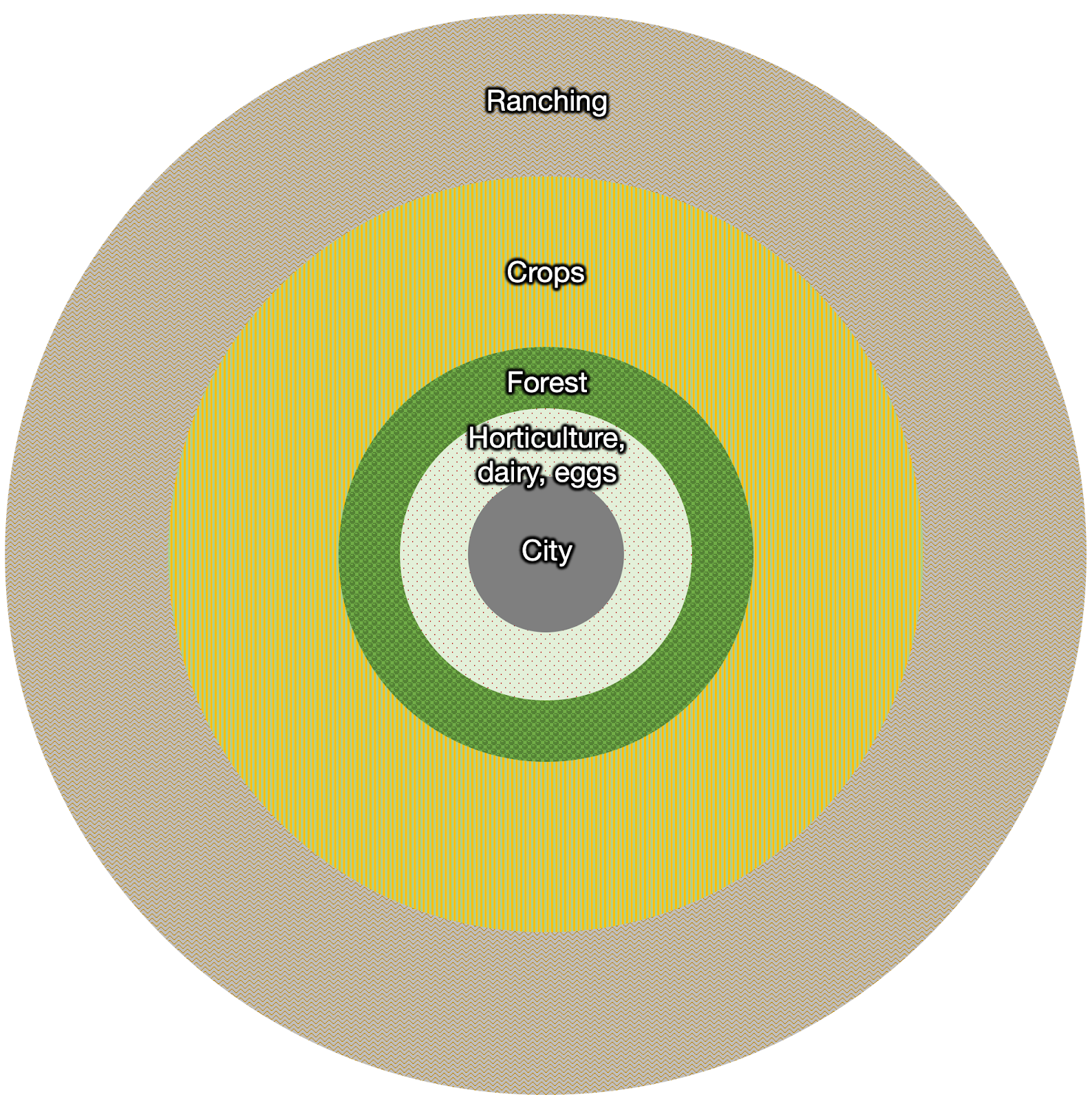
The food that must be consumed soon after production had to be produced within the city or close by.
Some forest land had to be close by too, because wood is heavy, so transporting it is expensive.
Farther out, grains, since they don’t spoil. They can be transported slowly and don’t need refrigeration.
Farther still, ranching, as cattle can move by foot.2
In this structure, farmers in the periphery sell their grain surplus to the city, which is one of the reasons that surrounding villages can’t be too big: They must produce a heavy surplus to feed the city, so they can’t have too many hands per farm.
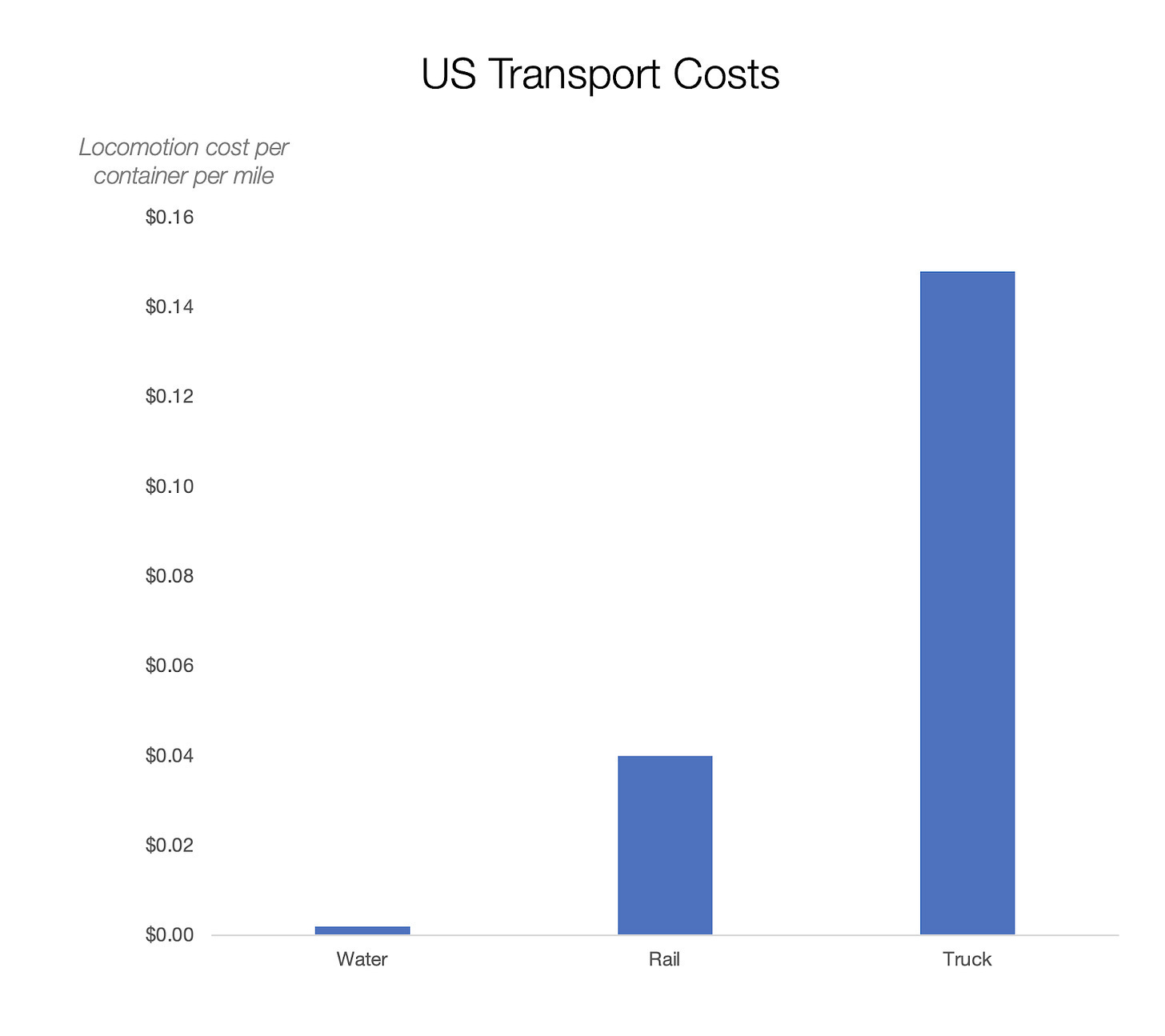
But as we discussed, transportation costs had a prominent role: They were so high that they could quickly make any product prohibitively expensive. And as you might know by now if you read Uncharted Territories frequently, river transportation costs could be 10-30x cheaper than overland.
The easier the river transportation, the faster boats could travel and bring food from faraway villages. This is why Ancient Egypt’s capitals were so rich, harvesting all the farming surplus of the entire Nile.
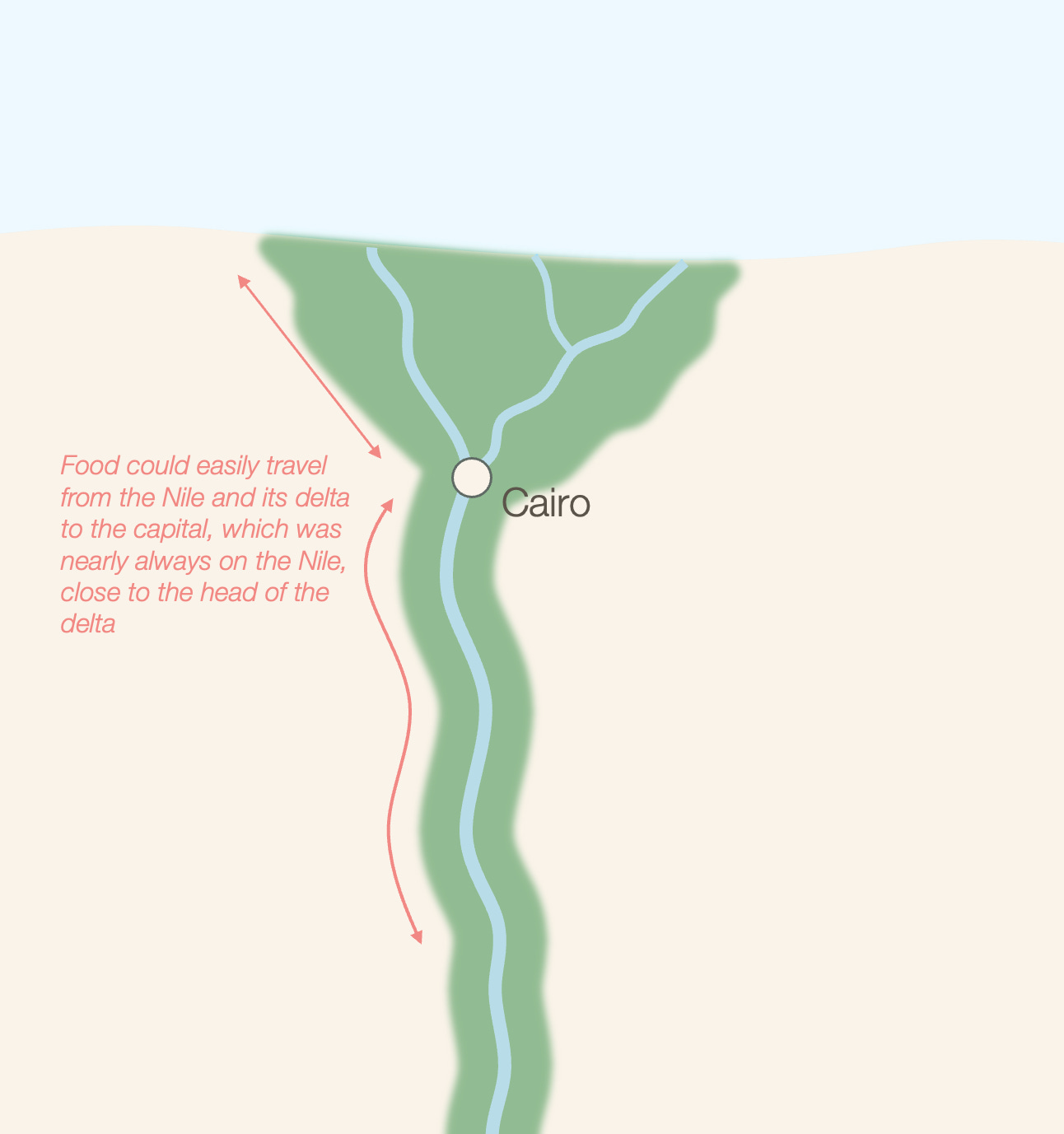
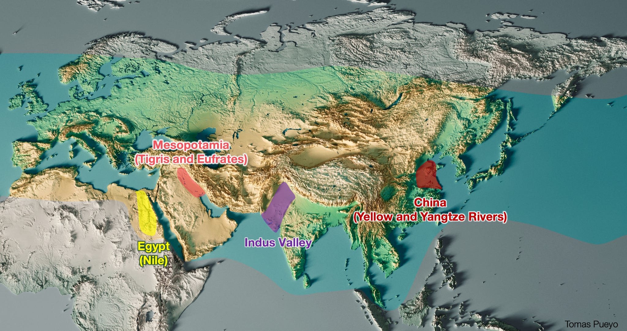
This is why all the earliest civilizations emerged along rivers, first as cities, which then conquered or allied with more and more land and other settlements along the same rivers.
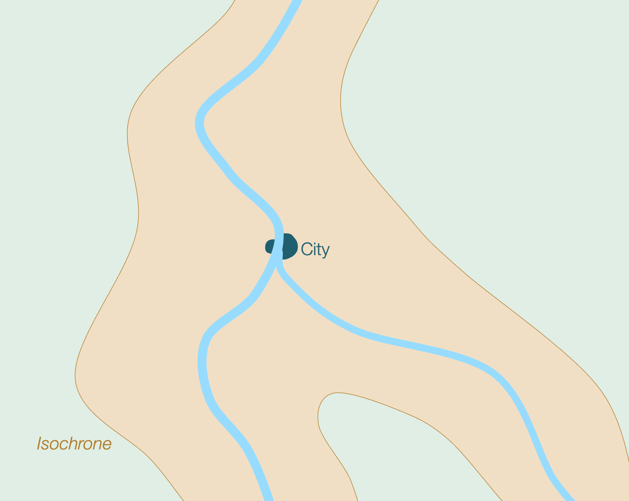
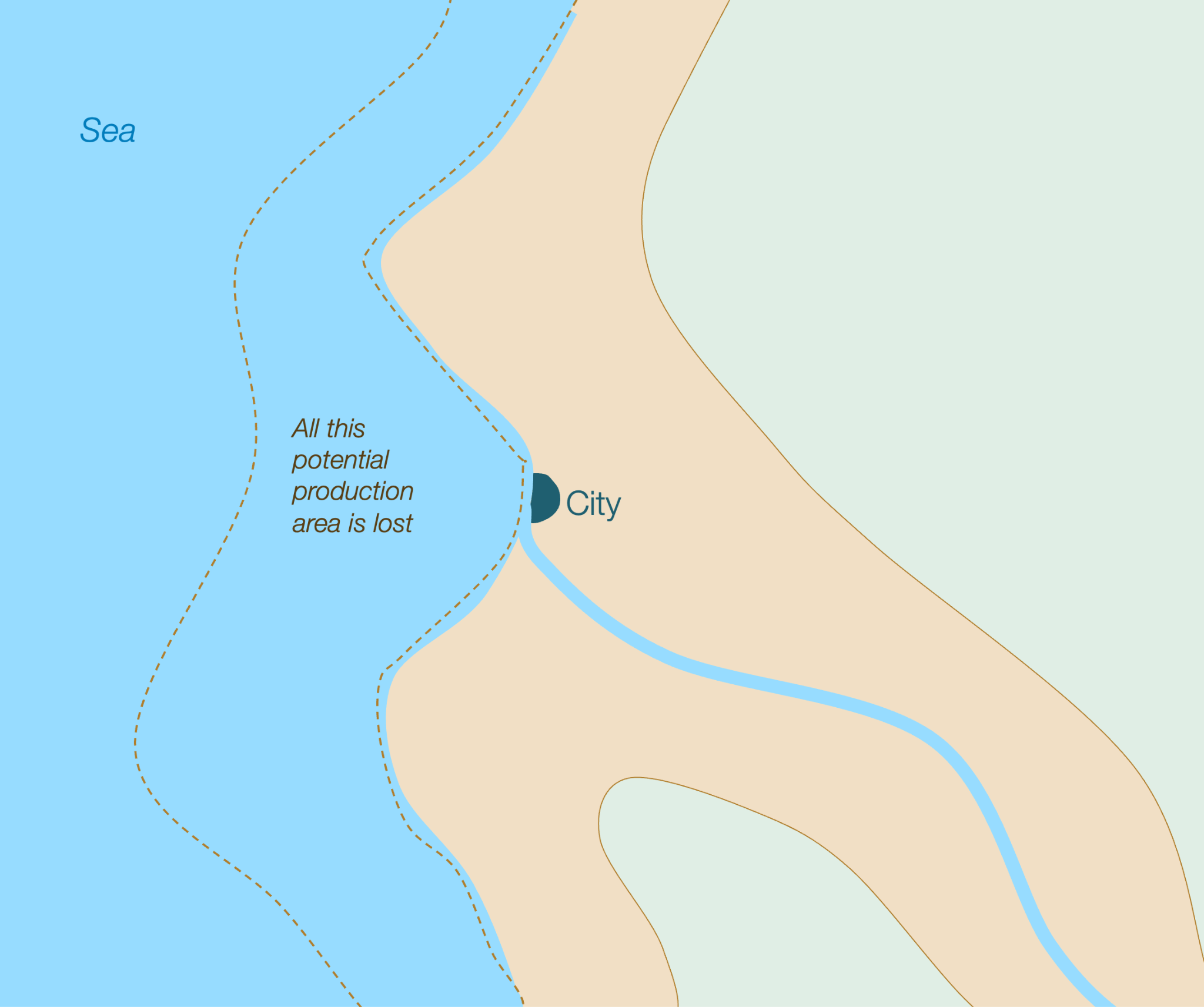
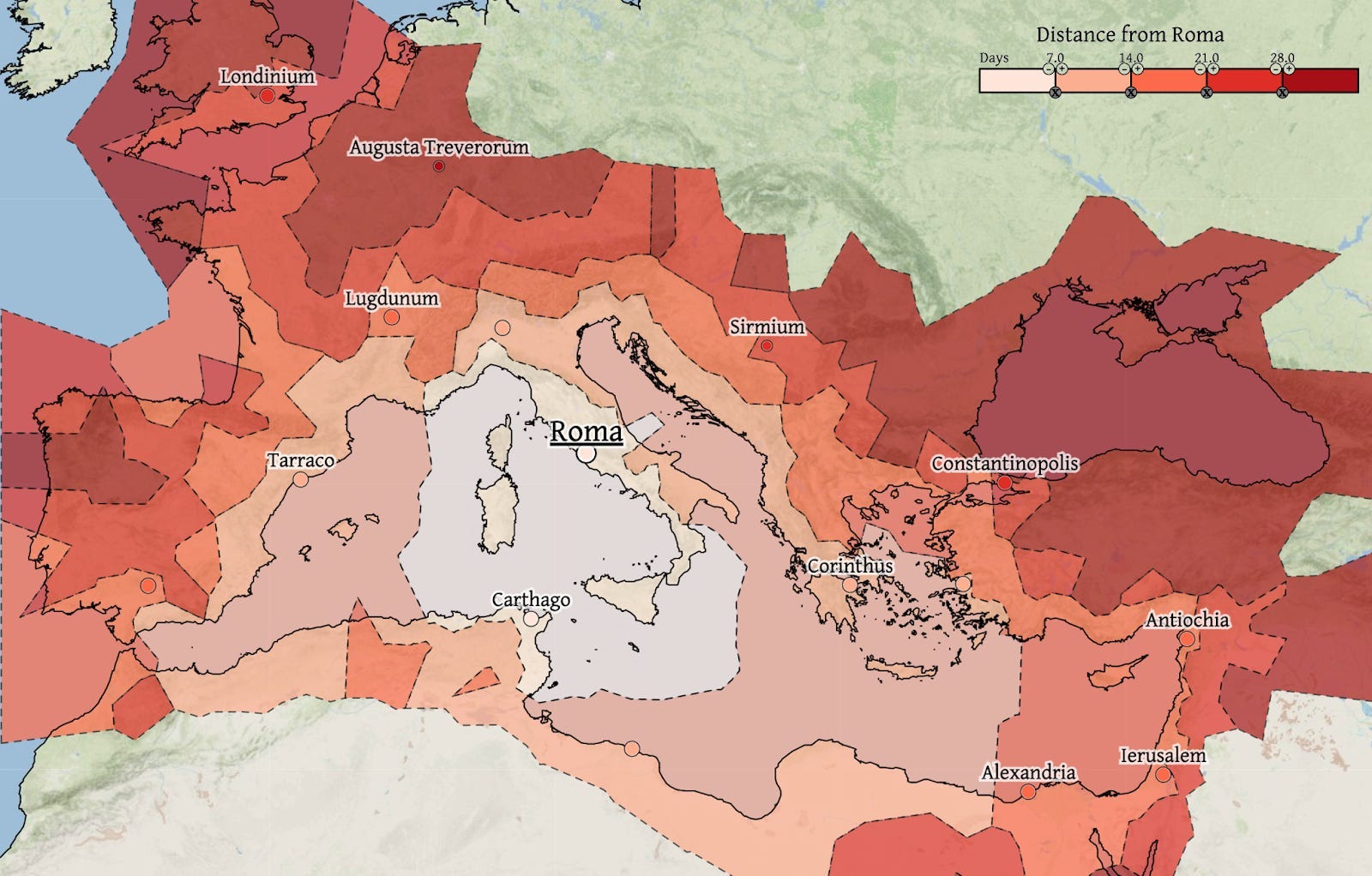
One way to get a sense of this is through “isochrones”:
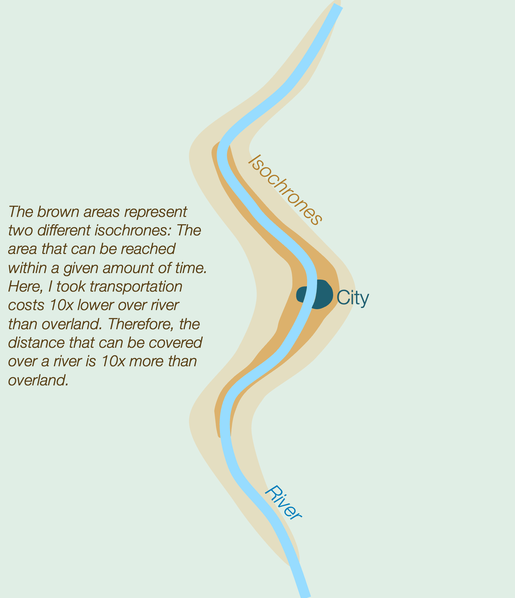
The confluence of rivers increased the influence area.
And this is also why rivers were better than coasts.
At a macro level, coastal cities allowed the emergence of big empires (and thus huge capitals). This is why the Roman Empire was called Roman (from the city of Rome) and why both Rome and its empire were so big: The Romans used the Mediterranean (Mare Nostrum, “our sea”) as a highway to transport grain from across the empire (notably Egypt). Its roads had the same effect.
Why gather in cities though? We mentioned in the previous article why people bundled in villages, but why get together into bigger groups?
There’s a clue in the paintings of Padova and London I showed before.
Defense
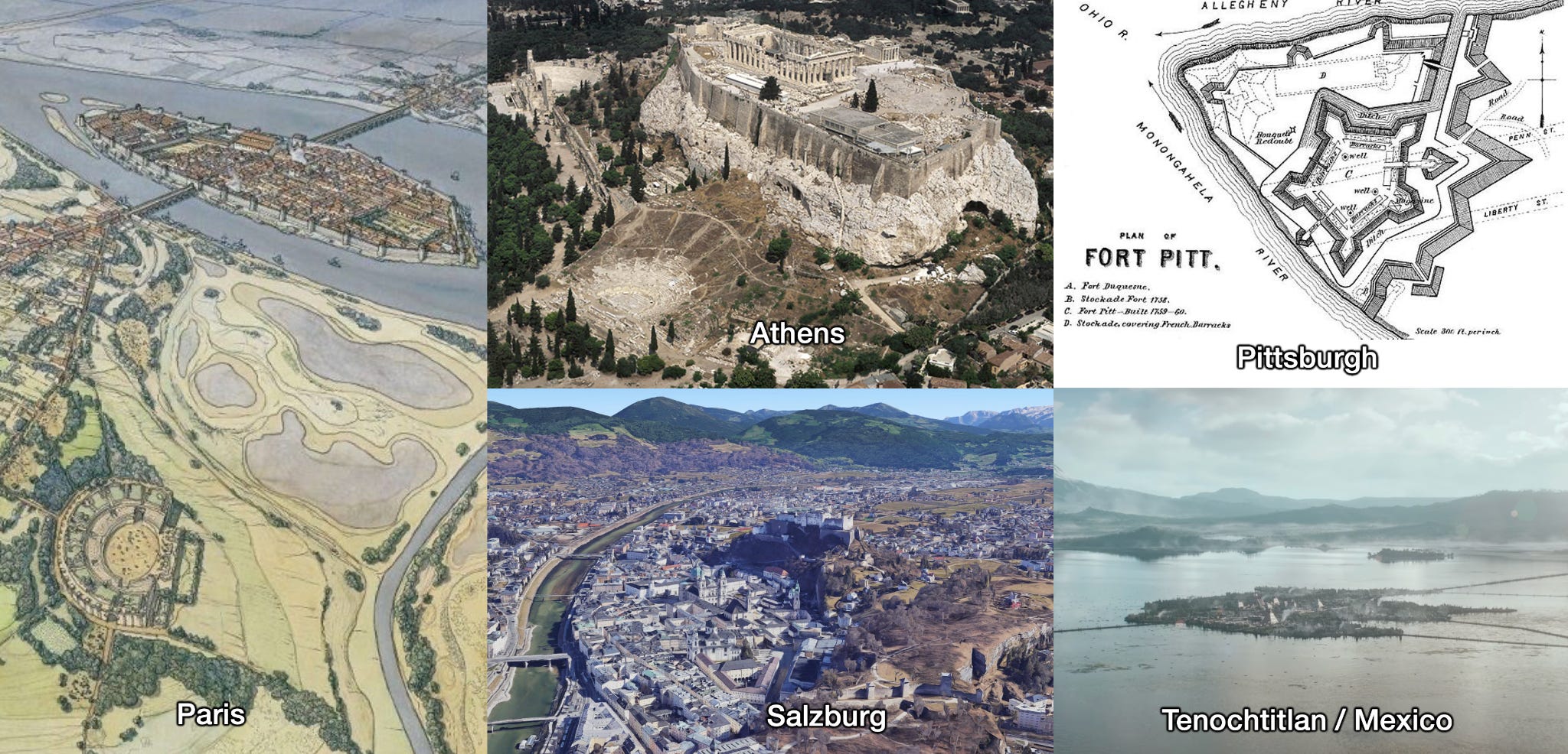
Of all the existing cities I know that were formed centuries ago, virtually all of them are in a highly defensible spot:
London was on a hill on the Thames. Other cities along a river with a fort on a hill include Athens, Carcassonne, Salzburg, Budapest, Prague…
Byzantium / Constantinople is at the end of a rocky peninsula, like San Francisco.
Pittsburgh and Lyon are on a hill at the confluence of two rivers.
Cairo (and all of Egypt) are protected on three sides by desert, and by sea on the 4th. The same was true of the early Indus Valley civilization..
Mexico was on a lake surrounded by mountains
Rome was on hills close to the Tiber river, in a marshy and malaria-prone area
Moscow was ideally suited to defend against the steppe hordes.
Many of the cities we know today in Europe and around the Mediterranean were founded by Romans first as military bases, and only after did they become cities. This suggests the more general mechanism:
Villages were attacked by neighbors or foreigners
They would pack into bigger towns to wall them and protect themselves3
Those towns that could protect themselves the best were more likely to survive and attracted more people, eventually emerging as big cities
Many of these cities were on rivers because of the protection, the water for drinking, for irrigation, to source food from farms along the river… And from trade.
The Trade Effect of Cities
In Why Some Cities Thrive, we covered the main mechanisms of how ancient cities grew:
They tended to start as military centers
Which transformed them into administrative centers
For protection, food, water (drinking and irrigation), and transportation speed, they tended to be on rivers
The ones that were on the best parts of rivers (navigable waters at the confluence of rivers or at their mouth) grew much faster than the others
In other words, the key factor that made a city grow a lot was being at the crossroads of cheap transportation lines. We see this in virtually all the cities I’ve covered.
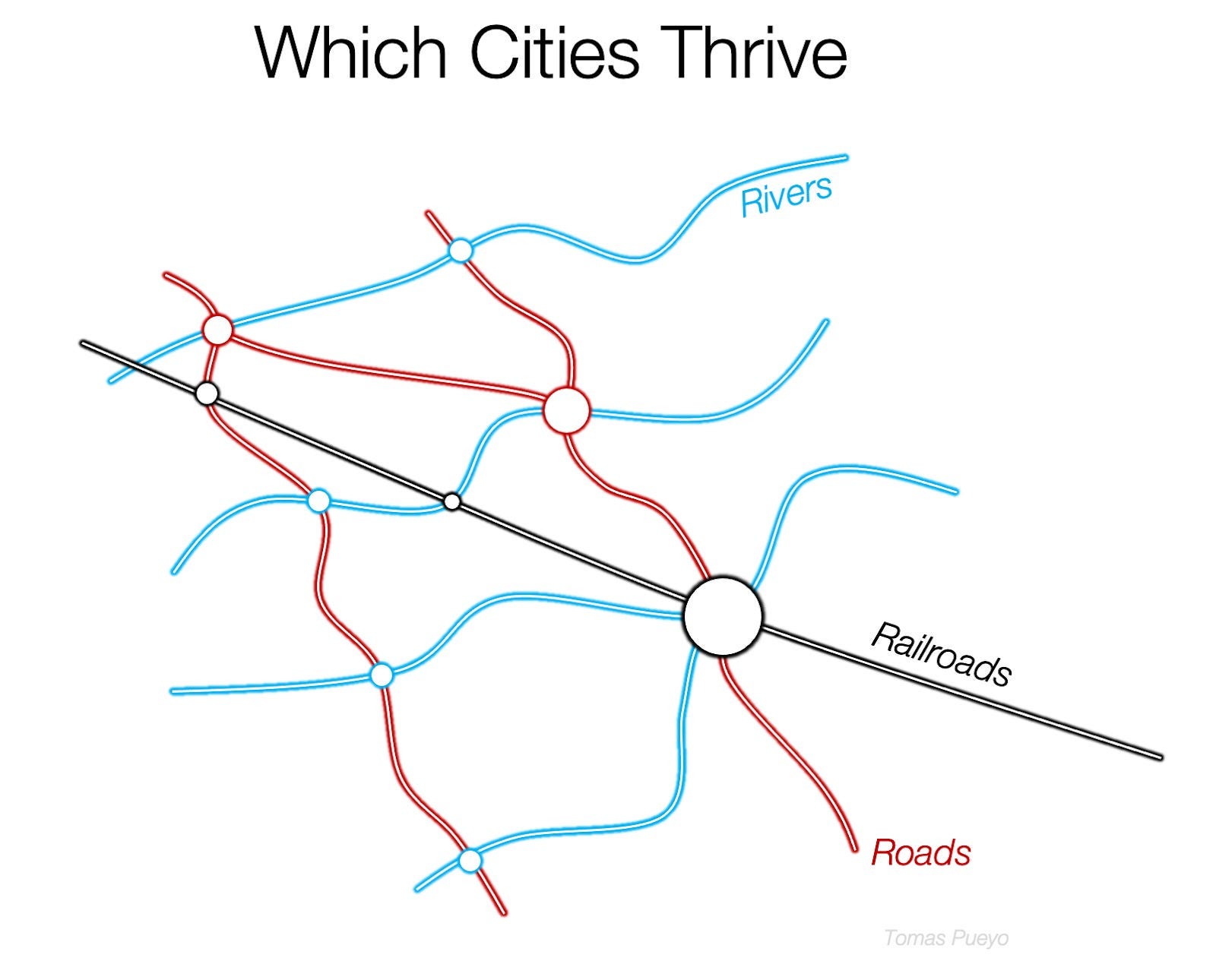
So the ideal city is a village that happens to be on the confluence of several calm, navigable rivers, on an estuary close to the coast, with a ford to cross the rivers, and near a natural road that connects important points.
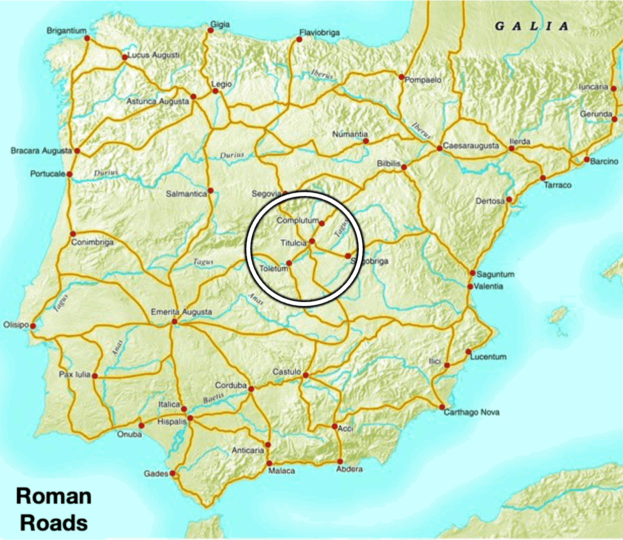
What’s a natural road? A line that quickly connects one important city to another through pretty flat terrain. You can see for example how many of Spain’s modern roads are close to where old Roman roads were:
Locations at line crossings evolved into marketplaces, which generated wealth that could pay for the grain and infrastructure needed to continue feeding them.
I explained how valuable rivers were for this process in Starship Will Change Humanity Soon:
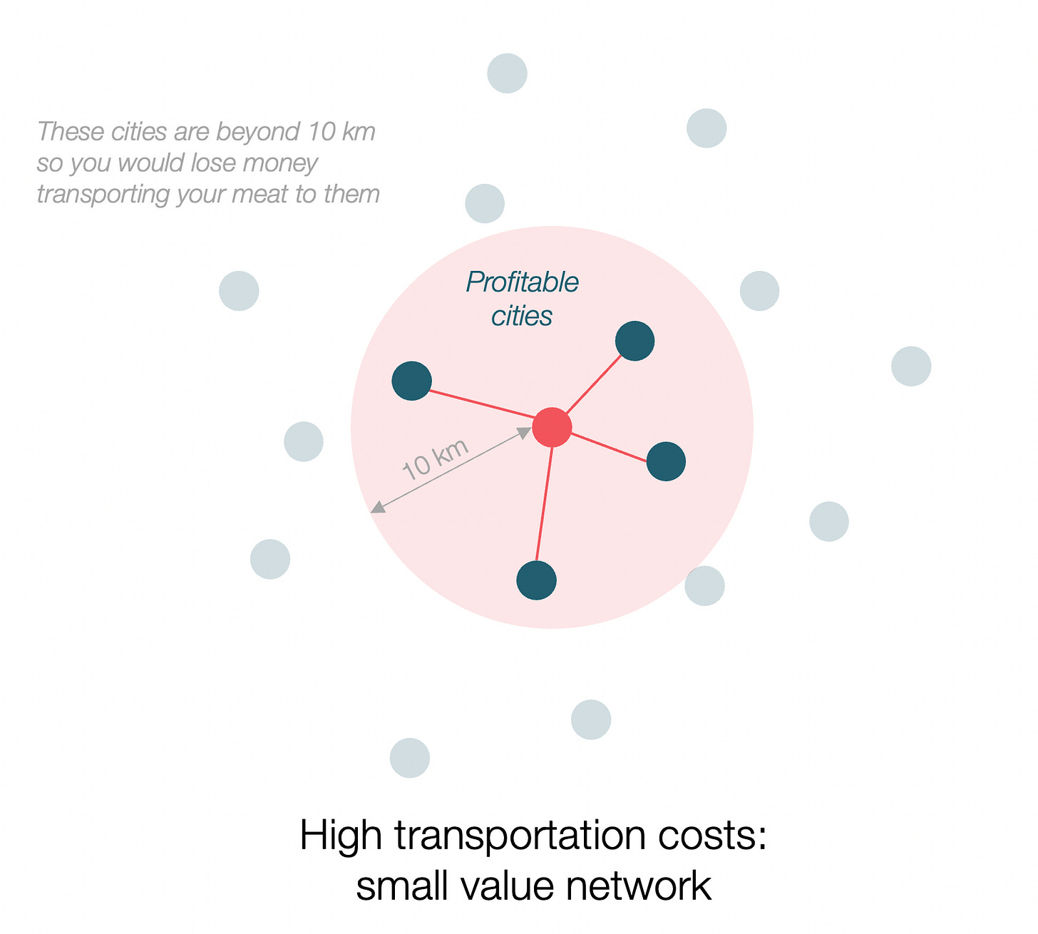
Imagine you sell meat and can make a profit of $10 for each kilogram you sell. But it costs you $1 to transport each kg one kilometer. Each additional kilometer you add, your margin is reduced by $1. You can only transport your product 10 km away. In the example below, that means you can only trade with four cities:
If instead, your cost of transportation is half of that, what happens? It costs you $0.5 per km. Now you’re increasing your margins with each of the cities that you trade with. But more importantly, now you can reach markets that are 20 km away.
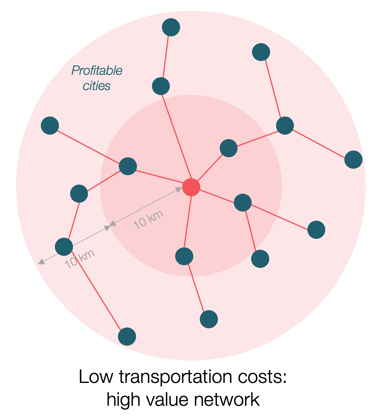
But when you 2x the distance, you 4x the surface! In this case, you can’t just trade with four cities anymore, you can trade with sixteen2! But according to Metcalfe’s law, the value of a network grows with the square of its nodes. Because now it’s not just your city that can connect to these sixteen other cities. Each one of these cities now can connect with sixteen other cities! All of them become richer, which means they, too, can now buy more meat.
This is what rivers do: By dropping the cost of transport, they connect huge numbers of cities, which can trade much more between them, become wealthier, their population can buy even more, and so on and so forth.
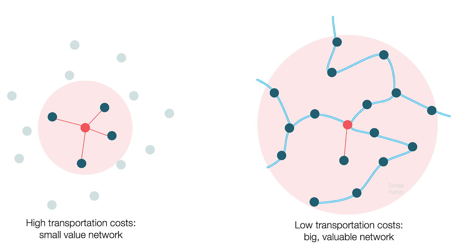
All in all, the value of the network to the right is at least an order of magnitude higher than that to the left! The cheaper the transport, the more trade at a lower cost, the more wealth generated, the more that wealth can be reinvested in better canals and bridges and roads, and the area’s wealth grows even further.
To use a concrete example, imagine the costs of $1 of woolen cloth. $0.30 could have been for getting the wool, $0.30 for converting it into cloth, and $0.40 for transportation. Let’s assume that, to make a profit, it is sold for $1.20. Of the $0.20 of profit, $0.15 goes toward the trader’s living costs, so he can save $0.05.
Now halve the transportation cost. Suddenly, the average profit rises to $0.40, and after living costs, the trader can save $0.25, or 5x more than before!4
But as we have seen, this also expands the market. Now the trader can cover 4x the area, so he will be able to sell 4x more cloth, so he will make $1 where before he was only making $0.05! Of course, this also increases by 4 the amount of wool production.
Or maybe more, because competition will bring prices down, which will increase demand. This competition emerges because more people see a profit to be made in wool trade. And they will sell their product wherever someone else is already selling it—to benefit from existing customers. The added variety will attract new customers, who will attract more sellers.
Soon, dyers will also come to dye the cloth with beautiful colors. Designers will innovate the cuts. Weavers will start co-locating in the same city, because that way they can see what sells, and they can make those types of clothes. Button makers will also settle nearby, to sell their buttons to clothmakers. Boats will specialize in carrying wool and cloth, making that trade more efficient. Soon, you have an entire industry that co-locates into the same city because of the economies of agglomeration.
